
Western and southern Mexico were on alert for severe storms on Thursday, and heavy rains are expected throughout the weekend, according to the Meteored weather service.
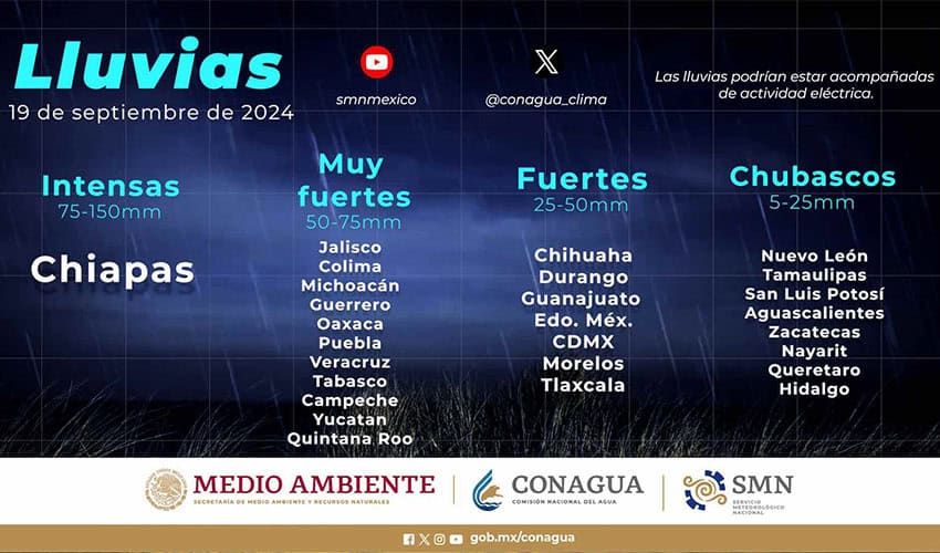
National Meteorological Service (SMN) predicts heavy rain in Chiapasand very heavy rains are expected in 11 other states in Mexico.
The storm is forecast to develop on Thursday, driven by Tropical Wave No. 23, which is approaching Mexico’s Pacific coast.
The system is expected to arrive in Michoacán and Colima on Friday just as Tropical Wave No. 24 moves across the Isthmus of Tehuantepec off the Yucatán Peninsula—where it is expected to interact with the Maya Trough (an elongated low-pressure system that frequently forms over the Peninsula).
Another trough extending from the northern mesas into central Mexico, combined with moist air from the Pacific and Gulf of Mexico, will likely produce electrical storms, gusty winds, and occasional hail storms across the northern part of the country.
Chiapas is expected to receive heavy rains (75-150 mm) on Thursday, while Campeche, Colima, Guerrero, Jalisco, Michoacán, Oaxaca, Puebla, Quintana Roo, Tabasco, Veracruz and Yucatán will receive 50-75 mm of rain. SMN said the system, driven by Tropical Wave No. 23, is likely to be accompanied by thunderstorms.
Meteored reports that the possible development of the Central American Gyre (CAG), a low-pressure system extending over Central America, could make this weekend — and the coming weeks — very turbulent for Mexico.
A CAG is a large-scale weather pattern that often leads to the development of tropical storms and hurricanes. It typically forms in late spring or early fall and can have widespread impacts, especially in the Gulf of Mexico and the Caribbean, especially if upper-level water temperatures and winds favor the development of tropical disturbances.
Meteored reports that such conditions do exist now. as tropical humidity and high temperatures meet a cold front blowing in from the north. Add in CAG and a tropical cyclone or two, and a major storm could be on the horizon.
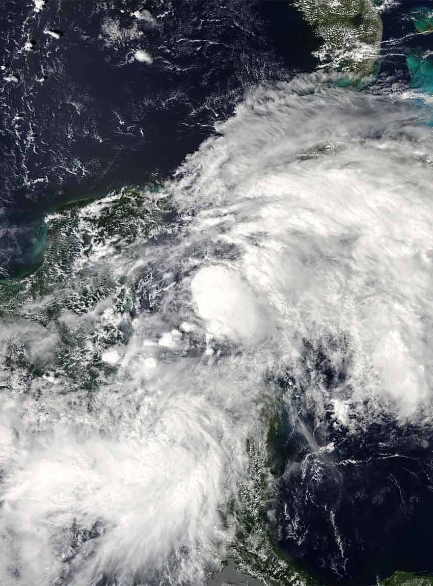
SMN also issued a warning about two low pressure areas that could produce tropical cyclones over the Atlantic in the coming days, while a potential low pressure system has been identified in the western Caribbean Sea.
Both systems over the Atlantic have a less than 30% chance of developing into tropical cyclones, but the system in the Caribbean has a 40% chance of becoming a tropical cyclone in the next seven days as it approaches the Yucatán Peninsula.
Another low pressure area appears to be forming in the Pacific south of the Baja California Peninsula. On Thursday morning, SMN reported that the system has a 20% chance of becoming a tropical cyclone in the next seven days.
With reports from hit by a meteor And Fox News


